Modernizing Conservation: New Tools for Protecting Logan County’s Land
For more than two decades, the Logan County Land Trust (LCLT) has worked with landowners to preserve farmland and natural resources for future generations. Now, the organization is modernizing the way it manages and monitors protected properties through two complementary technologies: the Landscape conservation management application and drone photography.
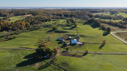
Together, these tools are helping LCLT move toward a more consistent, accessible and efficient approach to conservation easement stewardship. Aerial images are already being captured and uploaded into Landscape, connecting field observations with the organization’s digital property records.
LCLT has adopted Landscape, a conservation management application designed for land trusts and other conservation organizations. The application provides a central place to organize easement documents, property information, maps, photographs and monitoring records, reducing reliance on paper files and disconnected digital storage.
For a volunteer-led organization, having information organized around each protected property is particularly valuable. Authorized users can more readily locate historical records, prepare for monitoring visits and document their findings. A shared system also helps preserve institutional knowledge as board members and volunteers change over time.
Landscape supports the entire monitoring cycle: scheduling visits, reviewing prior observations, recording conditions and tracking follow-up. Reminders and assigned tasks can help LCLT keep annual monitoring on schedule and make responsibilities clear.
Its mobile app can be used without cellular service to navigate properties, record photographs and routes, and complete field forms. Monitors can consult easements, baseline documentation and earlier reports while in the field. Standard report templates can turn collected observations into consistent monitoring reports, reducing manual preparation.
Landscape also supports the work that takes place before and after a property is protected. LCLT can use project tracking to organize acquisition tasks, deadlines, funding and expenses, and connect those activities to the relevant property. This offers a clearer picture of conservation projects as they move from initial discussions through completion and ongoing stewardship.
Mapping tools can bring property boundaries, geotagged photographs and monitoring routes together. County parcel or other available map layers can provide additional context. Property-linked contact records and communication histories can help volunteers understand past discussions with landowners and maintain continuity when responsibilities change.
Custom dashboards and reports can help the Board review monitoring progress, outstanding actions and the conservation portfolio without assembling information from separate files. Permission settings allow access to be tailored to different roles, including volunteers and board members. Landscape also provides tools for tracking easement issues and reserved-right requests, helping preserve a record of decisions and follow-up.
These capabilities offer LCLT opportunities to reduce administrative work, improve consistency and preserve institutional knowledge. As implementation progresses, the organization can establish common procedures for record entry, report review and access management. Landscape supports these processes, but sound stewardship still depends on accurate records, appropriate review and ongoing landowner relationships.
Learn more about Landscape: https://landconservationsoftware.com/features/
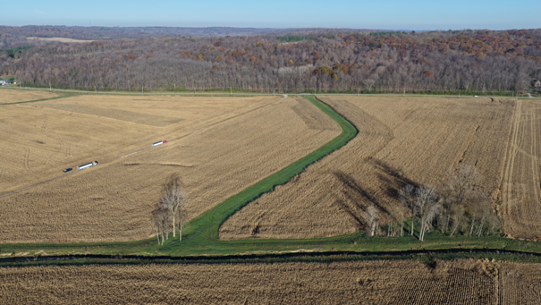
Conservation easement monitoring involves observing land conditions and assessing whether the conservation values and restrictions established in each easement are being maintained. Drone photography adds a valuable perspective to traditional ground visits and conversations with landowners.
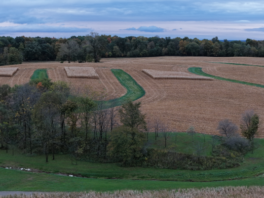
High-resolution aerial images can capture fields, farm structures, tree lines, waterways and other landscape features in a single view. They can help identify visible changes in land use, vegetation, drainage or structures that may warrant closer examination. Repeat photography also offers a way to compare conditions over time.
.
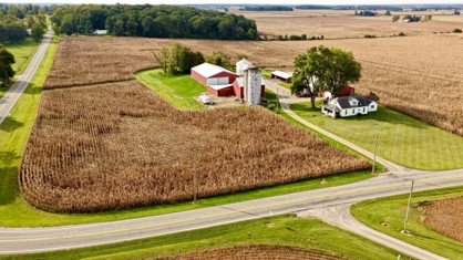
The integration is already underway: LCLT is capturing drone imagery and uploading it into Landscape. Instead of keeping photographs in separate folders or storage devices, the organization can associate images with the relevant property records and monitoring history.
This creates a growing visual record that can help future monitors understand earlier conditions, compare photographs from different years and prepare for subsequent visits. Drone imagery complements, rather than replaces, ground inspections, landowner communication and any monitoring required by individual easements.
The adoption of Landscape and drone technology is part of a broader effort to strengthen LCLT’s operations. A redesigned website and expanded news and educational content are helping improve public access to information about conservation, while the new stewardship tools support the work behind the scenes.
Drone services are provided by sTX Aerial Photography, LLC, owned and operated by LCLT Board Member Brett Patterson. An FAA-certified Part 107 remote pilot who has been flying since 2020, Patterson brings aerial photography and business technology experience to the initiative. His contributions are one example of how volunteer expertise can help advance the organization’s mission.
Protecting land in perpetuity requires more than securing conservation easements. It requires reliable records, consistent monitoring and the ability to carry knowledge forward from one generation of stewards to the next. By investing in practical technology today, the Logan County Land Trust is building a stronger foundation for that enduring commitment.